
A Lesson from the Fishers: Who Controls Resources? Who Defines Development?
Foodthink says
I. Storm Surges: National Parks and Islands
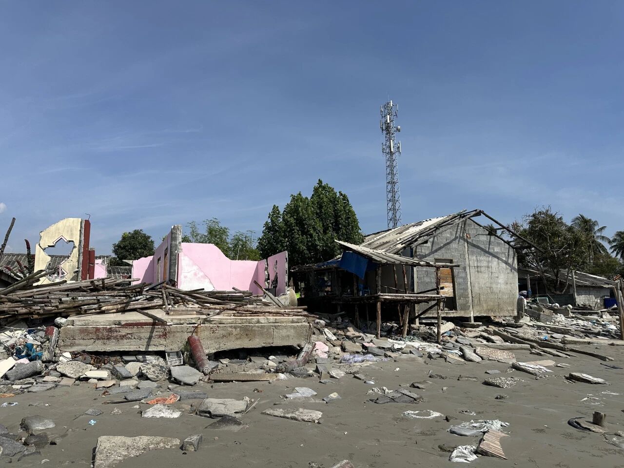
The fishers in this village are all Muslim, descendants of immigrants from Malaysia, and some still speak Malay today. The 17 households whose homes were destroyed have nowhere to live and still remain with relatives.
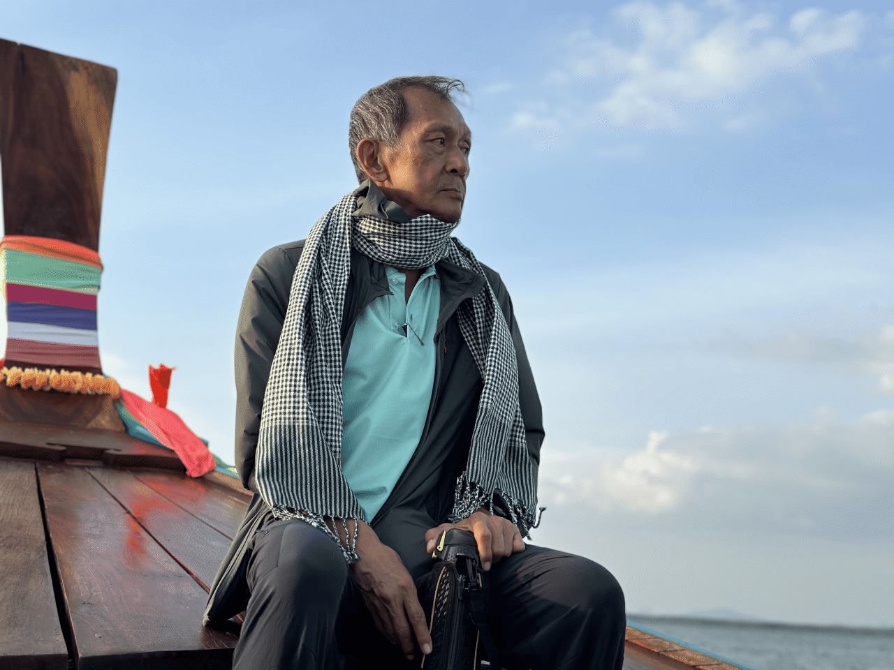
“There’s nowhere we can rebuild homes for these people,” Nok said. He heads the Save Andaman Network (SAN), an NGO in Trang province. His full name is Phakphum Vithantirawat.
Everyone calls him P’ Nok (in Thai, adding P’ before a name shows respect for an elder).
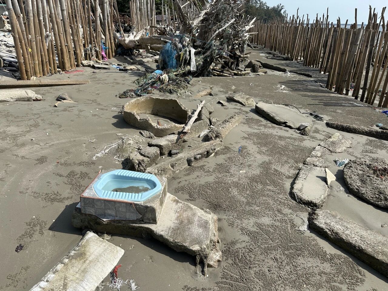
The reason is somewhat absurd: this stretch of coast falls within a national park, and authorities only permit villagers to rebuild on their original sites—nowhere else. Yet, traumatised by such a disaster, the villagers are understandably reluctant to build again in such a sensitive, fragile zone.
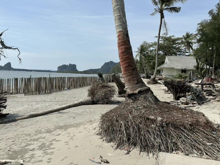
Moreover, the storm drove up water levels, severely eroding the coastline and washing away a layer of sand, bringing the sea closer to the village. With climate change, storms of this intensity are only likely to become more frequent. To rebuild here now would be little short of courting disaster.
But the villagers have little choice. This is far from an isolated case—across many countries, when land is designated a ‘national park’ in the name of conservation, the indigenous communities who have lived there for generations often end up losing access to the land, game, and timber they rely on for survival.
A core question here is: ‘Who owns the resources? Who has the power to make the rules?’ This has resonated most deeply with me throughout this trip. Indeed, almost everywhere we went, nearly every issue prompted reflection on this very question.
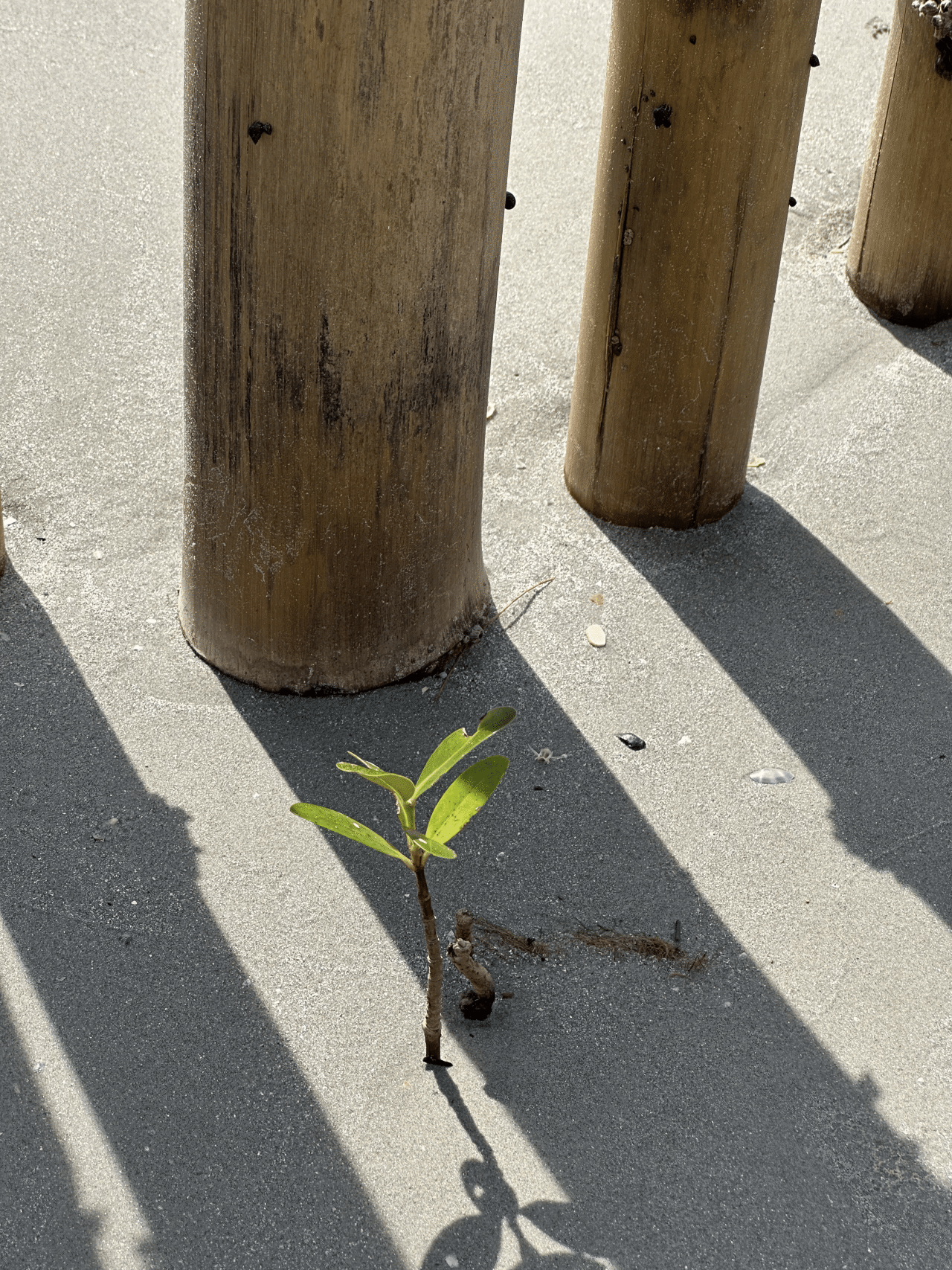
Yet the villagers have not given up. We came here to see several rows of bamboo poles standing between the ruins and the sea. These poles serve to dissipate wave energy and trap sand. The government originally planned to build a concrete seawall, but locals argued it would only reflect waves higher and trap water behind it with nowhere to drain. So they ultimately chose bamboo.
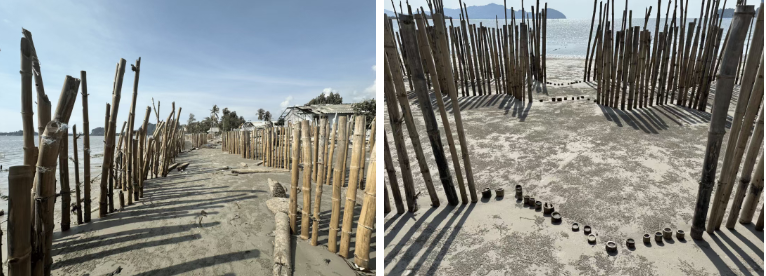
Government workers used high-pressure water jets to drill holes in the sand, driving the bamboo poles a metre deep, creating what to us outsiders looked like a striking spectacle: rows of bamboo stretching far across the barren beach. It may look crude, but it works. Experience shows it can trap up to 70 or 80 centimetres of sand each year—a low-tech form of land reclamation. In this way, humanity, small and deliberate, wrests land from the sea, inch by inch.
To secure this hard-won sand, villagers have planted mangrove saplings at the base of the poles, which are said to mature in three to four years. They prefer planting several together, so the saplings “grow up with friends and don’t feel lonely”. There is scientific basis for this: in areas prone to strong winds and waves, planting two or three saplings close together allows them to intertwine as they grow, reducing the risk of them being uprooted.
“Look over there, that’s a brand-new island!” the village chief, who was guiding us, pointed to a small, half-submerged patch of land not far out in the sea. Originally just a shallow sandbar visible only at low tide, it has transformed into a surprising little island in just seven years—perhaps the storm washed sand away here and deposited it there, accelerating its rise? Who knows. Coconut trees have already taken root, and fishers can now catch crabs in the surrounding waters.
Where seagrass meadows once thrived, makeshift land reclamation now stands beside bamboo poles, while a new island has emerged from the shallow waters. Vast landscapes can transform in just a few years. In that moment, I felt humanity was much like ants.
II. The Disappearing Seagrass and Dugongs
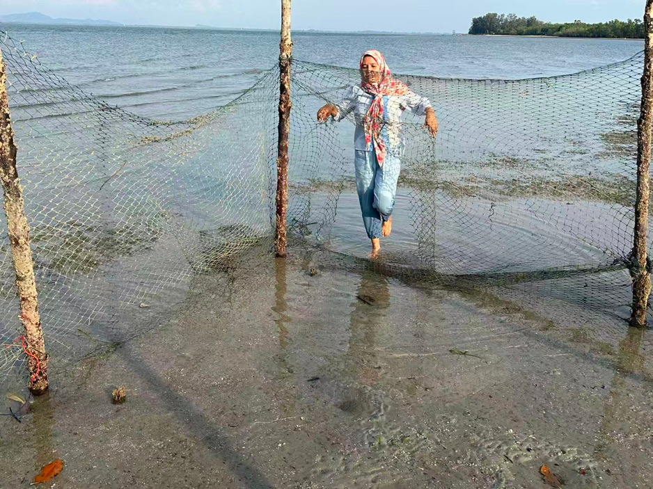
“Just walk,” he said.
I was startled to realise just how shallow the water was. We rolled our trousers up above our knees and stepped in barefoot; the water barely reached our knees. The sand beneath our feet was fine and soft, like treading on soft mud.
Only on getting closer did I understand that what I had taken for an algal bloom was actually aquatic plants growing on the seabed. In fact, it was a beach nearly exposed at low tide, covered by just a thin layer of water over the seagrass. The most abundant species had short, leafy blades—dugong fodder.
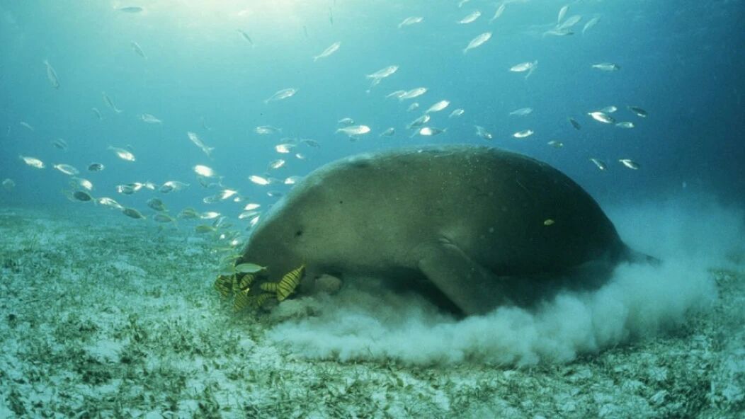
Nok pointed to several shallow troughs in the sand beneath our feet. “These are dugong tracks,” he said. Bathed in the slanting afternoon sun, the marks were clearly visible. When the tide rises, dugongs swim in here, pressing their snouts to the sand and undulating their bodies as they feast. A single adult dugong can consume up to 45 kilograms of seagrass a day.

Once seagrass beds are destroyed, dugongs are easily driven to starvation and even death. This is the tragedy that has been unfolding in these waters in recent years.
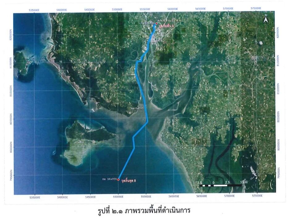
The root cause is the dredging project on the Kantang Channel of the Trang River. Carried out to accommodate larger cargo vessels, the project is intended to serve the broader regional development of the “Indonesia–Malaysia–Thailand Growth Triangle (IMT-GT)”. However, the dredged sediment and rocks were dumped into the sea and dispersed outwards from the river mouth. Although this area is a no-fishing protected zone situated at a considerable distance from the construction site, it has not been spared. According to Nok, the influx of sediment has nearly wiped out all the local seagrass beds. Members of SAN have encountered numerous dead dugongs in the area.
The dredging operations sparked public protests in 2020, forcing the government to temporarily halt the project. Experts were subsequently re-engaged to conduct a fresh environmental impact assessment to identify a suitable disposal site for the dredged material, with the aim of channel dredging that neither damages the ecosystem nor jeopardises the livelihoods of local fishermen.
This area once supported over a thousand hectares of seagrass beds, sustaining the largest dugong population in Thailand. Yet, according to Nok, the contractor’s explanation for this catastrophic outcome was simply: “When work began, we assumed the impact would be confined to the river channel.” Four years after the suspension—by 2024—seagrass only began to regrow here, which is precisely what lies beneath our feet.
According to a report by the US non-profit environmental news outlet Mongabay, Thailand’s dugong population numbered around 273 in 2022, with 90% residing in the Andaman Sea. Today, however, a third of that population may already be gone. In 2024, starvation due to widespread seagrass die-offs accounted for at least 40% of dugong deaths.
A government scientist interviewed by Mongabay observed that most of Trang’s dugongs had either perished or were wandering along the coast “searching for food”, venturing as far north as Krabi, Phang Nga, and Phuket, and even into Myanmar; to the south, at least three dead dugongs were discovered near Malaysia’s Langkawi Island. The scientist estimates that fewer than ten dugongs may now remain in Trang province.
In light of this, witnessing the recovering seagrass beds and the feeding trails that day felt like observing a hard-won survival. Yet Nok voiced his concern that the displaced dugongs face grim prospects; they must adapt to unfamiliar habitats and risk injury from colliding with unaccustomed fishing vessels. “In Trang, fishermen know how to control their speed to avoid dugongs; people elsewhere simply lack that awareness,” he said. “Here, we can protect them. Out there, we are powerless.”
The distant waters to which the dugongs have migrated may offer little sustenance; as the earlier Mongabay report noted, there are scarcely any viable seagrass beds around Phuket. Government officials have even attempted to supplement the migrating dugongs with kale and cabbage—the sort of diet typically provided to rescued dugongs in aquariums.
While fishermen may campaign and grieve for their own devastated homes, advocacy for dugongs, seagrass, and coral is largely left to environmental NGOs such as SAN.
Libong Island also supports a species of long-leafed seagrass that forms a key part of the sea turtles’ diet. Yet Nok explained that this seagrass requires two years to mature and reproduce; if grazed by turtles during this vulnerable period, it struggles to spread and form continuous beds. “So conserving sea turtles and seagrass can work at cross-purposes,” they remarked, looking troubled, despite the fact that one of the goals of seagrass conservation is precisely to feed the turtles.
They have been running something of a pilot scheme: marking out a small plot on the sand with bamboo poles and fishing nets to cultivate the long-leafed seagrass, but the results have been underwhelming. When we went to see it, the ground was almost bare, revealing only a few scattered shoots of the long-leafed seagrass just beginning to emerge.
III. Crab Bank
Since the 1990s, global demand for crab meat has surged. Unsustainable fishing methods such as trawling pushed Thailand’s blue swimming crab catches to a peak of 46,678 tonnes in 1998, far exceeding the maximum sustainable yield. In response, the Thai government introduced a series of policies to restore fish stocks, and grassroots initiatives began to emerge—the crab bank being one such effort.
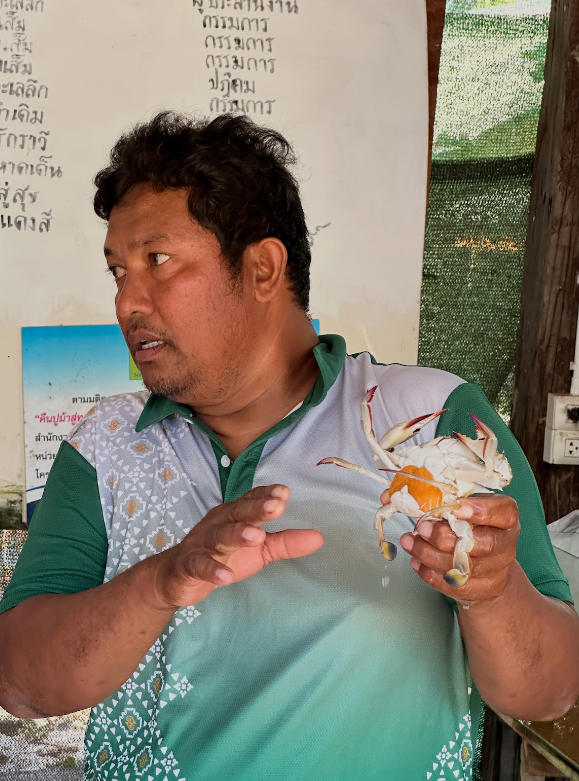
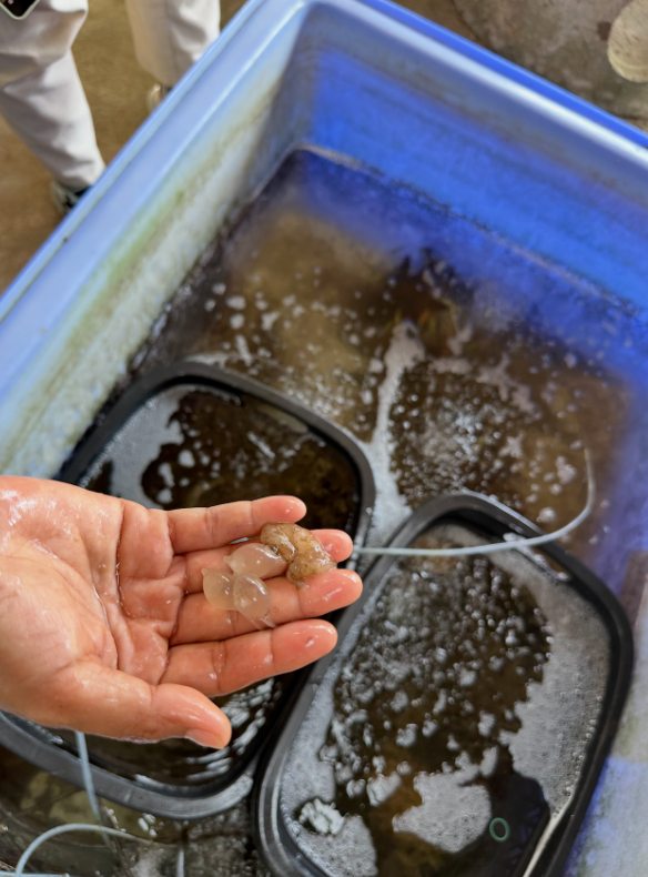
The crab bank we visited is located within a community conservation centre, housed in a simple wooden shed. A row of large blue plastic barrels sits on the ground, while glass tanks on a table are connected to a dense tangle of plastic tubing used to aerate the water. The village head casually plucked a female crab from one of the barrels; her underside was packed with a bright orange mass of eggs. Tens of thousands of eggs adhere to her abdomen via mucus. The orange hue indicates the eggs are still developing. According to the village head, once the eggs turn grey, it signals she is close to hatching them, and she must be returned to the sea within five days.
These eggs will hatch in seawater into planktonic larvae, with a single female potentially releasing hundreds of thousands to millions at once. The village head believes the crab bank has been beneficial for stock recovery. He noted that whereas blue swimming crabs were once only catchable for six months of the year, they can now be harvested year-round, providing a crucial livelihood.
Fishermen have developed a habit of bringing not just blue swimming crabs, but other marine creatures in their breeding stages, to the facility for temporary care. We also spotted squid eggs, resembling a cluster of clear grapes. These had accidentally become tangled in someone’s net while hauling it in, prompting the fisher to bring them back.
According to Mongabay, data does show that blue swimming crab populations have increased since the implementation of crab banks and “other measures.” In 2017, Thailand’s Department of Fisheries, WWF, and several private sector partners launched the Fisheries Improvement Project, promoting initiatives such as crab banks, seasonal bans on catching egg-bearing females, and restrictions on trawling and specific gear types (for instance, crab pots with mesh sizes under 6.4 cm).
However, restocking alone is insufficient. Amonsak Sawusdee, a marine biologist who has studied blue swimming crabs for decades, simultaneously emphasised that establishing and enforcing appropriate gear regulations, alongside creating sanctuaries for spawning and juvenile crabs, are equally critical.
Within the very same waters, large-scale engineering projects that decimate seagrass beds coexist with fishermen’s Sisyphean crab banks—a rather absurd tableau to an outside observer. Yet it is precisely this grassroots initiative, forged through cooperation between fishing communities and NGOs, that has resisted destructive industrial ventures and overfishing, safeguarding native species.
How can this model of conservation, rooted in local knowledge and co-governed by coastal communities, be institutionalised? LMMA offers a pathway—this is the “community conservation area” model, jointly managed by government and civil society, that we will now explore.
IV. LMMA Empowers Communities to Manage the Sea
LMMA emphasises the coexistence of conservation and livelihood, recognising that this balance is essential for communities to remain in place. The next field note will explore how fishing communities are forging their own sustainable livelihood models. In this piece, we first examine how such a framework—involving diverse stakeholders including government agencies, non-governmental organisations, and civil associations—is put into practice.
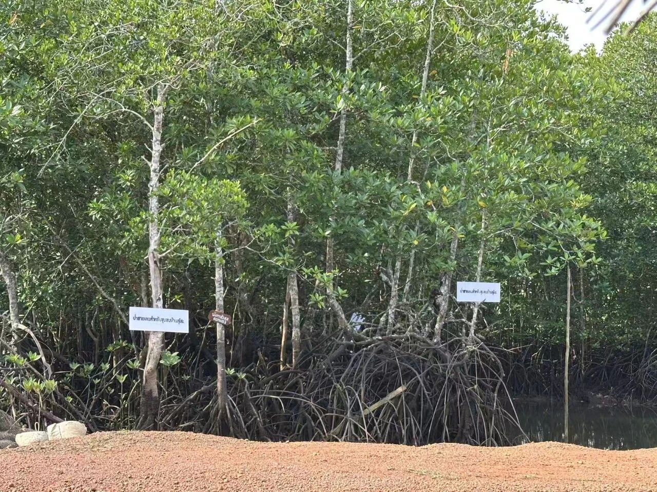
First, it should be noted that, much like in China, Thailand’s marine and coastal resources (such as mangroves) are classified as state assets. The corresponding administrative body is the Department of Marine and Coastal Resources (DMCR), which also oversees community conservation areas. Sites designated as marine national parks carry a higher protection status and are managed directly by the Department of National Parks, Wildlife and Plant Conservation.
Yet during our visit to the renowned Mu Ko Phetra National Park in Satun Province, we found two community conservation areas embedded within its boundaries. A senior official from the local national park authority explained that for its first 42 years, the park operated under a strictly closed management system. In biodiversity conservation, “protected areas” are designated zones aimed primarily at species preservation—national parks being the classic example—but this approach has frequently displaced indigenous populations in various regions.
However, managers eventually recognised this approach was unworkable and conceded that local people must be permitted to make a living within the national park, provided it is done sustainably.
As we spoke, we stood beneath a blue sign erected at the shoreline the previous year. It announced the management regulations for the community conservation area, outlining its boundaries, prohibited activities (such as the use of illegal fishing gear), and penalties. The map at the centre of the sign showed the entire area falling under the national park, with yellow and orange zones demarcating the community conservation areas for two respective villages.
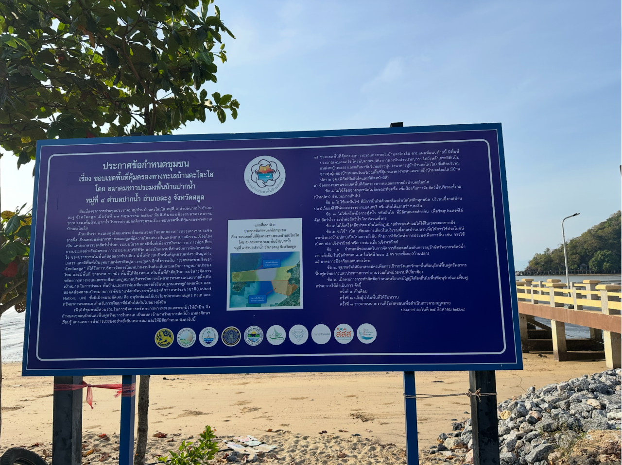
Fishing is strictly restricted throughout the entire national park; if fishermen wish to fish, they are permitted to use only traditional gear. However, within the yellow and orange community-managed marine areas shown on the map, fishermen can carry out more extensive fishing and foraging. This comes with accompanying responsibilities: species monitoring, patrolling, and the construction of fish habitats. At first glance, these two community-managed areas might seem to be encroaching on the national park’s resources, but correspondingly, they require fishermen to demonstrate that they can restore the marine ecosystem alongside their fishing activities.
Interestingly, these community-managed areas, known as LMMAs and overseen by the DMCR, actually fall within the boundaries of the national park. They answer to different government authorities, and in terms of legal standing, the National Parks Act supersedes the community area management framework. In effect, the LMMA operates as a governance model embedded within the national park’s statutory framework. Reaching this stage has undeniably depended on years of positive interaction and mutual trust among various government departments, fishermen associations, and NGOs.
In practice, LMMAs are indeed established through negotiation between the community and the government. To qualify as a community-managed area, a site must meet specific criteria: the community must hold traditional or established use rights, have a clearly defined organisation (such as the fishermen association we met on this trip), and have reached internal consensus to draft a set of management rules.
NGOs often play an indispensable role in this rule-making process. Internally, they focus on awareness-raising and capacity-building, such as training fishermen in species monitoring, community mapping, rules of procedure, and legal literacy. Externally, they frequently act as “intermediaries”, “translating” the community’s rights claims into a register that facilitates dialogue with government bodies and stakeholders. This is especially crucial when navigating the technical legal language required for policy advocacy and legislative proposals.
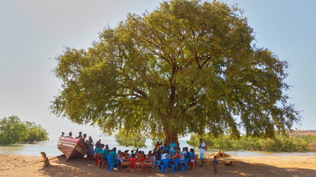
This bridging role is clearly reflected in how our visit was arranged. Our meeting and conversation with the national park’s management leadership was facilitated by an invitation from the Thai Sea Watch Association (hereafter “Sea Watch”). Whether in Sea Watch’s office, on a boat touring marine reserves, or sitting on the ground chatting with villagers in the community, the attendees represented a wide range of backgrounds: community representatives, women’s advocates, local council members, and government officials—often from multiple agencies simultaneously, such as the DMCR and the National Parks Department. Even when half-day discussions required tiring sentence-by-sentence consecutive interpretation, they remained patient and engaged throughout.
Fishermen must draft their own community regulations. In Satun, fishermen from the several LMMAs collaborating with Sea Watch were also asked to name their respective protected zones. Through this highly ritualistic act of “naming”, they are encouraged to develop a tangible sense of community ownership.
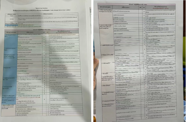
The management rules of an LMMA must also be endorsed by all the government departments involved in its oversight. Tab, the head of Sea Watch, showed us a memorandum of understanding signed by the community, the local government, and NGOs. Two large sheets of paper were densely covered in Thai script, detailing management regulations that had been negotiated clause by clause and ratified by all parties. Just for the community component alone, there are nineteen categories. For example: “Do not act alone; you must collaborate with partners. Partners may be government departments, NGOs, or even neighbours.”
Language is a tool for thought, and coining concepts is also a common tactic for NGOs in policy advocacy. For instance, the concept of OECM—Other Effective Area-based Conservation Measures—emerged to drive global conservation efforts. Many LMMAs can be registered as OECMs, but Tab says they prefer the LMMA concept.
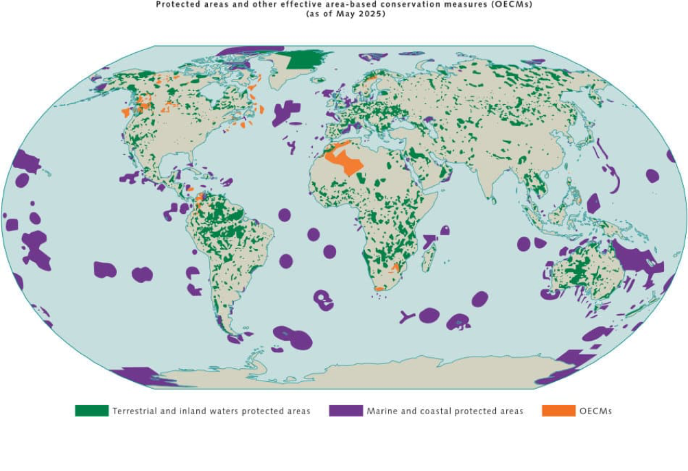
An OECM refers to areas outside designated protected zones that, through governance, can consistently achieve in-situ biodiversity conservation outcomes, such as urban green spaces or nature-friendly farmland. In 2018, OECM was formally defined as a statistical tool under the Convention on Biological Diversity. Countries must report them to track global conservation targets and progress.
Whether it is protected areas or OECMs, these concepts were pushed onto the global environmental governance agenda by international institutions; in other words, it is a “top-down” process. Driven by international negotiations, OECM is becoming a standard term recognised and used by governments and international organisations. Many community-managed areas have the potential to be registered as OECMs. Although they may not receive direct funding like formal protected areas, the OECM designation makes it easier to secure external support, such as international cooperation and carbon credit projects.
However, NGOs and fishermen tend to prefer the more grassroots LMMA concept, which places greater emphasis on community-led management. Tab’s casual attitude towards OECM revealed an interesting shift to me: Grassroots NGOs seem less interested in the prestigious, grand-scale concepts of international environmental governance frameworks, and instead prioritise approaches that reflect autonomy and deliver tangible benefits.
V. Rejecting Carbon ‘Enclosure’
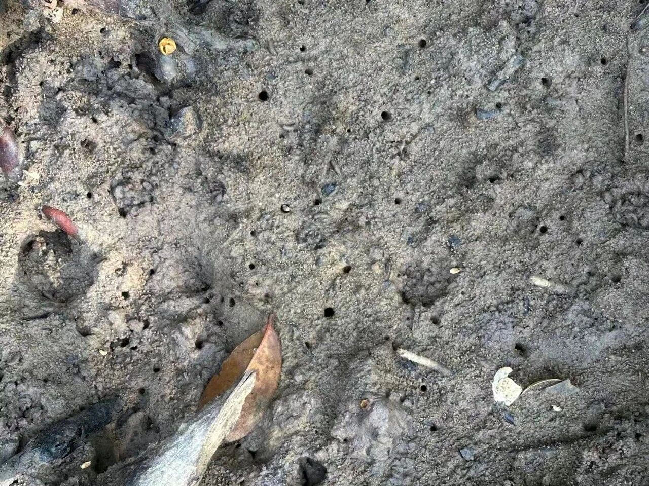
This stems from a past where a company occupied the local mangroves for 21 years under a charcoal production concession. During that period, villagers had to seek company approval to use any timber—a requirement that was virtually impossible to fulfil, leaving them no choice but to cut wood secretly. Over time, they noticed food was becoming increasingly scarce in and around the mangroves. They regard crabs and shellfish as indicators of ecosystem health: not only were these populations declining, but some marine life had vanished altogether. Villagers attribute this directly to the company’s logging. A straightforward example is the mud crab, which digs burrows to live in the soft soil. Without the trees’ shade, the sun bakes the ground until it is too hot for the crabs to survive. Put simply, without the mangroves, wildlife loses its habitat, and what was once a vibrant, life-rich shoreline degenerates into a barren wasteland.
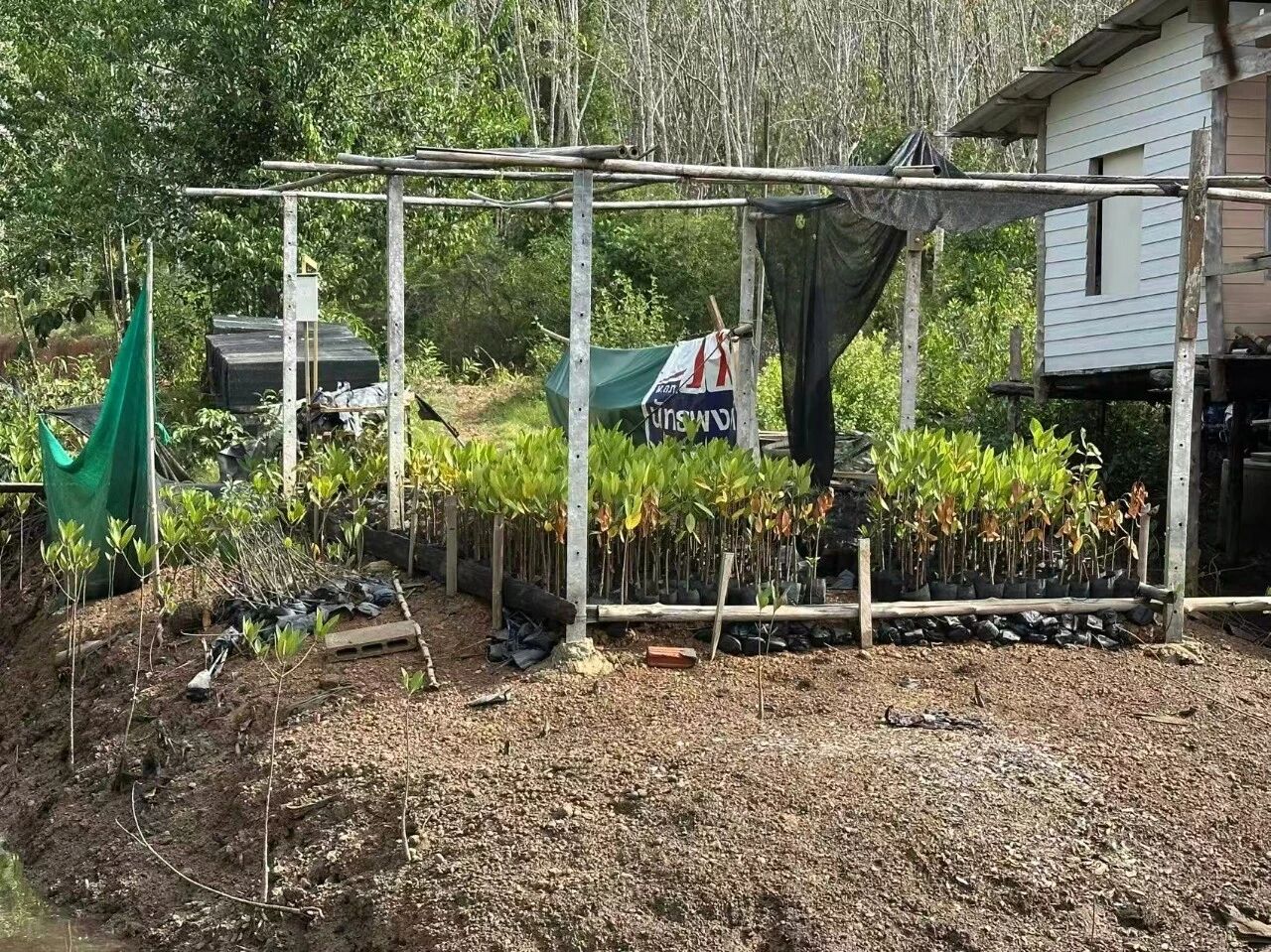
Consequently, once the concession expired, some villagers who had recognised the issue began planting trees spontaneously. Five villages formed a mangrove conservation group and applied to the DMCR for community-protected area status.
In 2024, the application was approved. They successfully secured a designation as a “community forest”, which grants them a decade-long management right over the mangroves and provides legal backing for the community’s claim to resource usage.
A 2025 report by the Knowledge for Development Foundation found that, against the backdrop of the climate crisis, the Thai government has been vigorously promoting voluntary emission reduction schemes, allowing companies to purchase carbon credits by funding mangrove restoration to offset their greenhouse gas emissions. However, grassroots implementation of the scheme has sparked serious equity concerns. For instance, in existing projects, profit distribution heavily favours corporate interests: companies take 70%, communities receive just 20%, and the DMCR claims 10%. Neither the companies nor the government have ever provided the community with a transparent explanation for this breakdown.
Furthermore, the DMCR and companies frequently bypass the wider community, approaching village heads or select representatives to sign agreements directly. In some cases, villagers have been coerced into signing contracts under government pressure without fully understanding the terms. This top-down, opaque approach has sown distrust and division within the community.
Speaking to HaRDstories, Tab argued that mangrove carbon sink projects cannot genuinely address global warming. “The UN principle is that whoever emits should take responsibility for remediation, yet it has been twisted into a scheme to create a carbon market for us,” he said. “Addressing global warming requires reducing emissions, not paying money to claim something that does not belong to them.”
Now, with their community-protected area secured, residents feel far more empowered to say no to such enclosure projects.
Coming up next
This is the second of a three-part series by Foodthink documenting visits to small-scale fisheries communities in southern Thailand. The first article, Thirty Years of Collective Ocean Protection: Unity Brings Fish to the Table | Visiting Southern Thailand’s Small-Scale Fisheries Communities, explored how small-scale fishers in Sadao District joined forces to drive away commercial trawlers, and how local fishers’ associations have further organised into a national alliance to actively engage in legislative and policy advocacy. To find out how conservation and development coexist in local fisheries communities, stay tuned for the third and final article in the series.

Unless otherwise noted, all images in this article were taken by the author.
Editor: Pei Dan